Canberra to Darbys Falls near Cowra
Sunday, Jan 9th
We set off just before lunch and headed up the Barton Hwy to Yass. A lovely old town with a great little museum where the drawn images of the old town are shown below photos of the same sites in the 1990s. This seems a clever way of displaying past and present, particularly as artefacts relating the building use were displayed below the pictures.
From Yass we headed north-west to Boorowa where the purchase of cherries removed the necessity to drive to Young! A cup of tea on the riverbank gave us a chance to appreciate the level of flooding that had occurred in this region as the debris was caught in the trees metres above the present river level. As we headed on towards Cowra we could see the storm happening along the ridges and in the valleys ahead, with fork lightning and loud claps of thunder coming with torrential rain – a very tropical storm as we were still in shorts and t-shirts. At one point we stopped on the roadside and waited for the storm to pass. As a result, we decided not to stop in Cowra, particularly as most of the points of interest were new, but the information about the biggest prisoner of war escape in modern warfare is well worth reading. We drove on to Darbys Falls campsite beside the Lachlan River where we were astounded to see the picnic tables and seats covered in mud – the river here had risen over 9 metres! Hard to envisage. Even the toilets were covered in mud. We spent the night there, with thousands of cockatoos coming in to roost in the trees, the carp in the river taking Graeme’s worms and the cicadas noisily settling in for the evening too. We were the only ones there over night and woke to the raucous screeching of the cockatoos and a warm wind.


 |
| Huge branches carried by the flood waters |
 |
| Flood debris high in the trees |
 |
| Clean creek water flowing into the muddy Lachlan River |
Darby’s Falls – Flat Rock near O’Connell
Mon. Jan. 10th
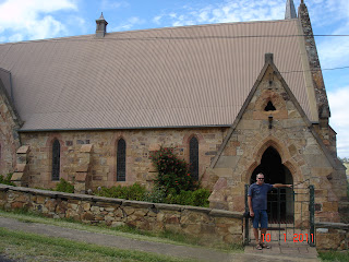
Carp, cicadas and a cacophony of cockatoos! Wonderful soundscape! We drove on through rocky but very green hills .. no sunburnt country in sight, and came to the beautifully preserved and restored village of Carcoar, a very special place. The first buildings dated to 1836, the year that the colony of SA was being established and one year after Melbourne was founded. The surrounding countryside of magnificent hills and valleys made good sheep country however the discovery of gold in the 1860s in this region, which includes Bathurst, is evident in the magnificent churches and civic buildings from the boom years. Wind farms on the hills indicate the local weather conditions!


We visited nearby Millhurst, another beautifully preserved gold rush town before heading into mighty Bathurst with its huge buildings and streets that reflect its days as the centre of the area’s economy. Bathurst was much larger than we had expected and the buildings from the early days were certainly built on a grand scale. As we are determined to keep off the main roads and out of the large towns as much as possible, we did our shopping and headed out to the Fish River camping site at Flat Rock. A magnificent spot with a fast running river and, of course, a large flat rock!

As it was very windy weather and overcast, it was time to put on a jumper for the 1st time. A few fellow campers and some day-tripping fishermen but very quiet once again. Some phone calls to home, before we moved out of range, indicated that the rain was still pouring down in Queensland and Toowoomba and Brisbane were in real trouble. Stu assured us that he was safe in Brisbane but that the office was not. As a result, we decided that our trip should continue in a westerly direction after we have been in the Blue Mountains, Richmond and Windsor.

As it was very windy weather and overcast, it was time to put on a jumper for the 1st time. A few fellow campers and some day-tripping fishermen but very quiet once again. Some phone calls to home, before we moved out of range, indicated that the rain was still pouring down in Queensland and Toowoomba and Brisbane were in real trouble. Stu assured us that he was safe in Brisbane but that the office was not. As a result, we decided that our trip should continue in a westerly direction after we have been in the Blue Mountains, Richmond and Windsor.
Flat Rock to Windsor and back again ... the best laid plans J
Tues. 11th Jan
Misty Blue Mountains, Windsor, misty Blue Mountains and Lithgow and beyond – not that we saw anything! Set off feeling non-too-comfortable about the weather. We arrived in Katoomba in rain and grey mist and we left an hour later in worse conditions! Not a sight to be seen. On to NSW Roads Dept.‘s constant road disruptions but for little immediate outcome! Most country roads are in poor condition while the city roads are being constantly closed or limited for roadworks!
We went as far east as Windsor and enjoyed walking around the historical buildings in this Lachlan Macquarie and Francis Greenway village on the Hawkesbury, however the inclement weather and news reports about the QLD and NSW floods led us to head back over the mountains and on to a little roadside stop at Capertee, just out of Lithgow. Heading north is not an option, so it’s westward ho!


No comments:
Post a Comment